![]()
- CONTENTS
- EVENTS
![]()
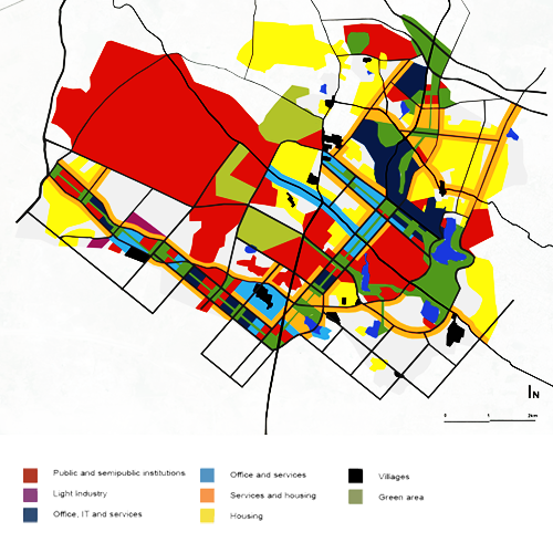
Maps
the maps below are a vital part of the exhibition
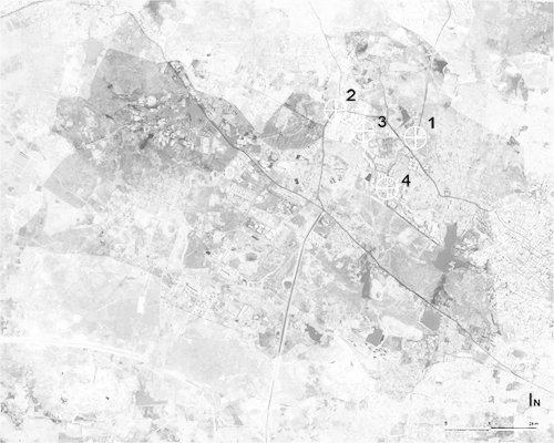
Aerial photograph 2010 (1-4 demarcate the panorama locations)
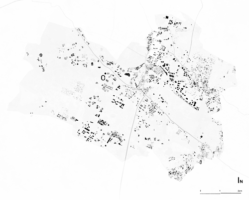
Building footprints in 2010
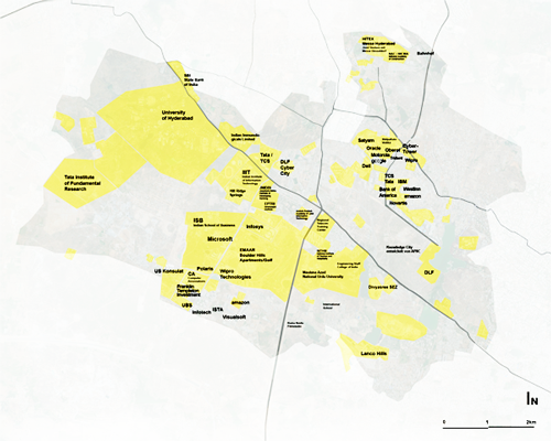
Share of companies and institutions in 2010, in yellow
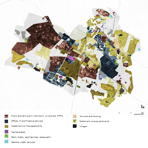
Land use mix from villages to IT services in 2010
Masterplan by the renown architect and urban planner B. V. Doshi from the year 2001